Equal to all,
fair to the Earth
This is the project for all people on the earth. The earth is round.
A 3D globe with no install, no account and no server. Share the GIS data you made with everyone on Earth.
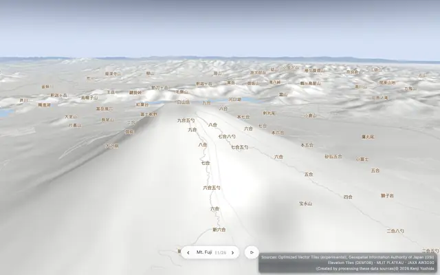 A demo that draws everything with one camera — from Japan's city data (PLATEAU) to the Solar System, from flat maps to 3D maps.Equal Earth26 languages
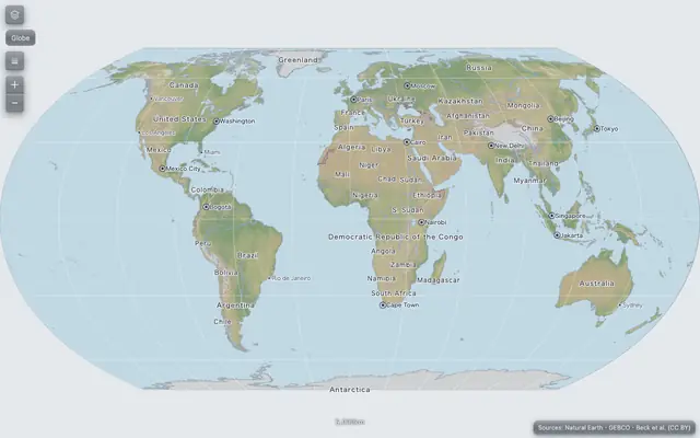 A scrolling Equal Earth world map with choropleths. Right-click any point to turn it into a 3D globe centered there.World quiz26 languages
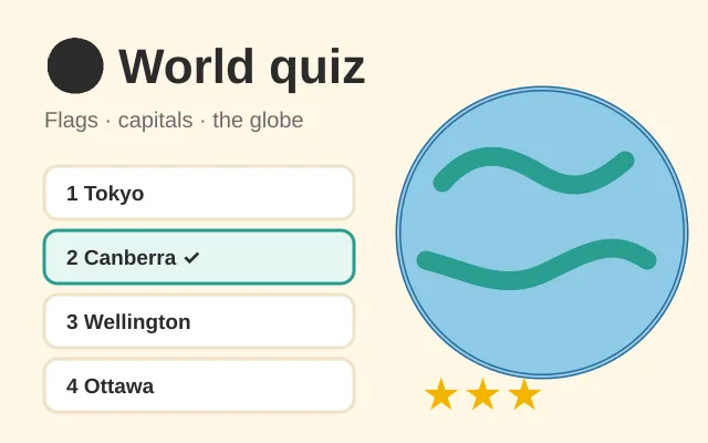 A geography quiz for kids and grown-ups: flags, capitals and where countries are on the 3D globe. Three levels, the whole world or one region, stars and badges — and the countries you miss come back until you know them.geoedit26 languages
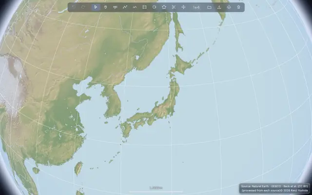 A map editor. Draw and fix shapes on the 3D globe, and save them as GIS data.Nations of the World26 languages
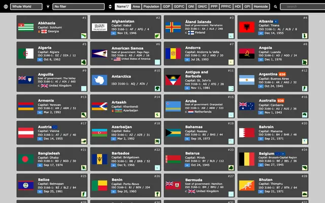 Basic data for the countries and territories of the world, as cards — facts, flag and anthem, Wikipedia and map.Landforms of the World26 languages
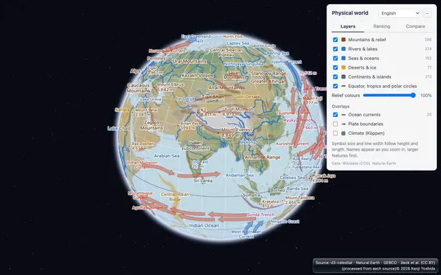 Mountains, rivers, lakes, seas and deserts of the world on a 3D globe — rank them, compare their heights and lengths, and overlay ocean currents, plate boundaries and climate zones.National Parks of the United States26 languages
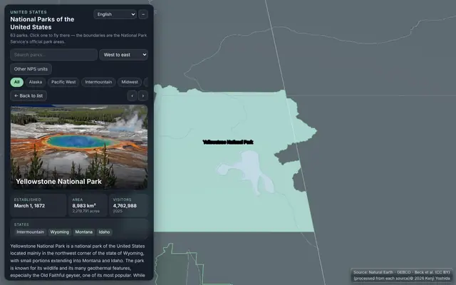 All 63 national parks of the United States on a 3D globe — photos, the National Park Service's boundaries, facts and Wikipedia links.World earthquakes26 languages
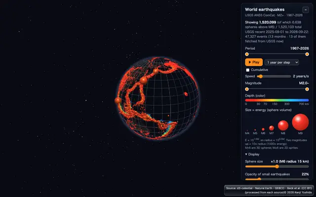 Reads USGS earthquake data directly and shows each quake in 3D by its energy and depth. It can also play year by year or month by month.Satellites26 languages
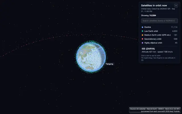 The current positions of satellites from CelesTrak data. Click a satellite to draw its orbit in 3D.Clouds now26 languages
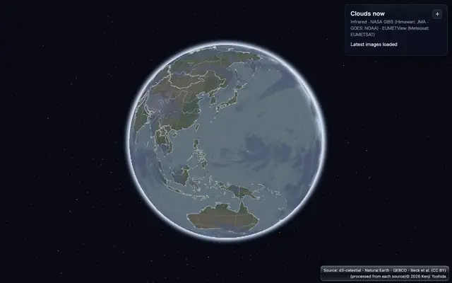 Infrared images from five geostationary weather satellites (Himawari, GOES, Meteosat), read straight from NASA GIBS and EUMETSAT and drawn in 3D over the globe.ortho-solar26 languages
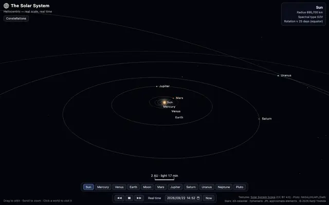 The current positions of the planets and their moons — and a replay of how they move over time.Daily calendar26 languages
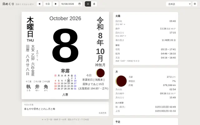 A Japanese tear-off calendar (lunisolar date, rokuyō, solar terms, holidays) with sunrise, sunset, twilight and the Moon for where you stand, computed with your elevation. Scroll a week without end; add your own iCal.Make a video26 languages
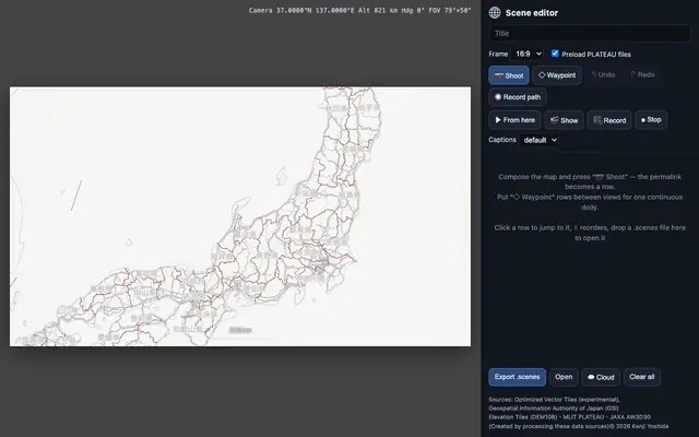 Cut out scenes of the 3D map and save or play them as one continuous video.GeoPBF26 languages
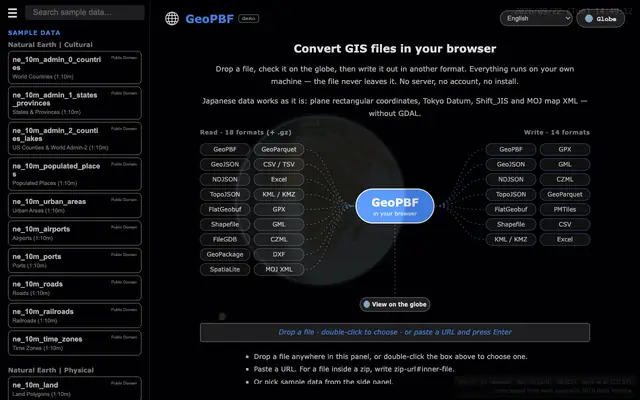 Drop a GIS file, check it on the globe, write it in another format — 18 formats in, 14 out. The file never leaves your machine.Japan's open GIS dataJapanese only
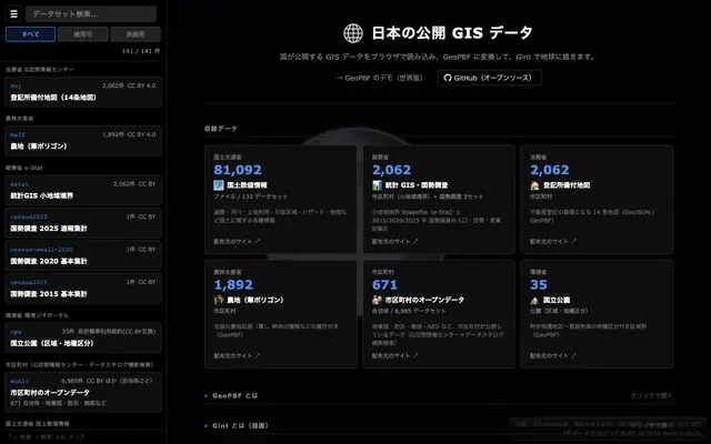 View and convert the open GIS data published in Japan.census2020Japanese only
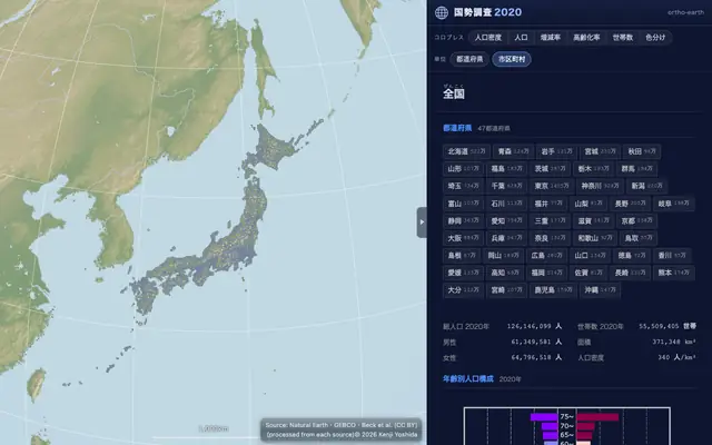 Drill down into Japan's 2020 census — small-area statistics, disaster risk zones and land parcels.Satellite data (COG)English only
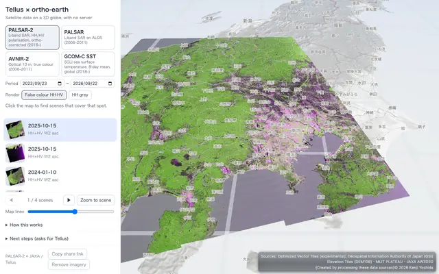 Satellite images (COG) on a server (Tellus), laid over the globe in 3D.ortho-japan26 languages
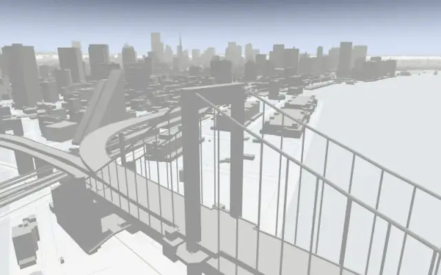 A map drawn only from Japan's public data. Try out the basic features.National Parks of Japan26 languages
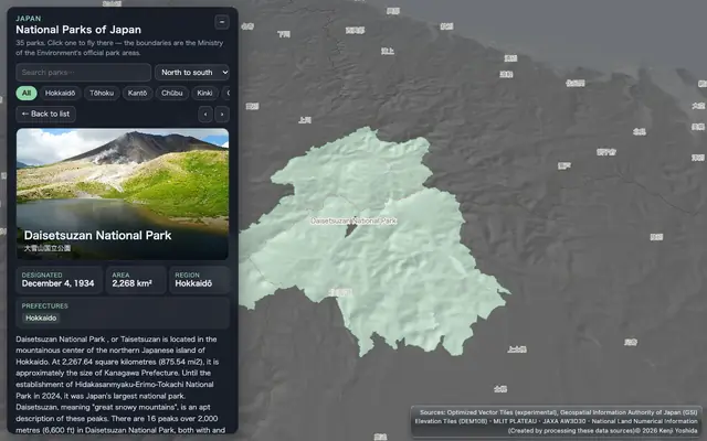 All 35 national parks of Japan on a 3D globe — photos, the official boundaries, facts and Wikipedia links.Hot springs of Japan26 languages
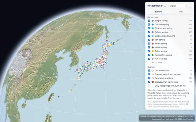 About 2,000 hot springs of Japan from Wikipedia on a 3D map, colored by spring type, with onsen districts, distant sources and member inns of the Japan Secluded Hot Spring Association.Landforms of Japan26 languages
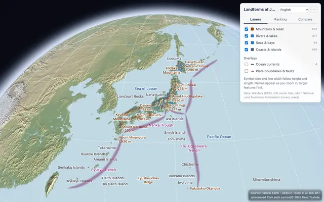 Mountains, volcanoes, rivers, lakes, plains, islands and seas of Japan on a 3D map, with their heights, lengths, areas and depths side by side.GLB models26 languages
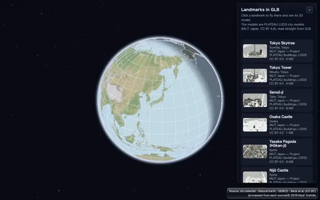 Landmarks such as Tokyo Tower, placed on the globe as GLB models. Download them in a range of 3D formats.Fireworks over Sumida26 languages
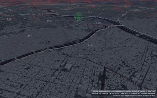 Full-scale fireworks (a 10-inch shell opens 320 m wide at 330 m) launched over the Sumida River, hidden by the buildings and Tokyo Skytree in front of them.Statistics in 3D26 languages
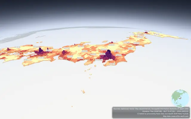 A 3D graph from the 2020 census — every municipality raised by its population density.An old map of Edo26 languages
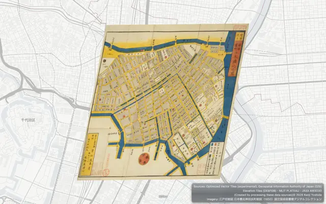 A woodblock map of Nihonbashi from 1850, read as IIIF tiles straight from the National Diet Library and laid on today's Tokyo by its control points.ortho-nl26 languages
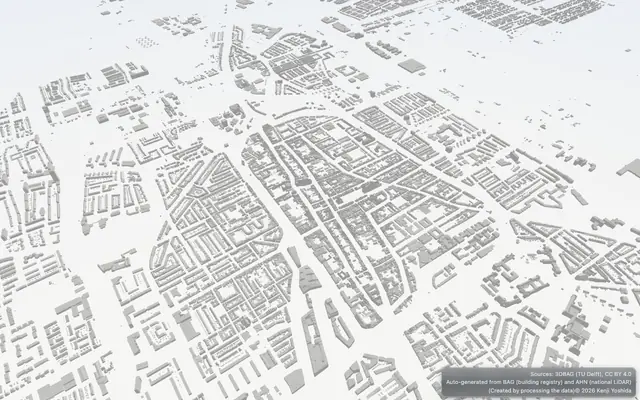 The Netherlands in 3D — 3DBAG buildings standing on OpenStreetMap vector tiles and terrain. Hop between eight cities, from Delft to Maastricht.
Free to use in education, always. Ready to use as is in classrooms around the world.
Look first, then build — with code or with an AI agent. Every step here is run by an automated test against the published npm packages.
The globe keeps getting faster and its API stays consistent: every change passes the same automated checks before it ships, so what you learn here keeps working.
Look
Open any demo — nothing to install. Drop your own GIS file onto the globe; it is read in your browser and never uploaded.
ortho-japan GeoPBFBuild with code
Vite and npm — the whole world first, then your own data on top. The API is MapLibre GL JS, so if you know MapLibre there is nothing new to learn.
- Create a project and add the globe
npm create vite@latest my-globe -- --template vanilla --no-interactive cd my-globe npm install npm install @ortho-earth/globe - Tell Vite about the globe's workers (vite.config.js)
export default { optimizeDeps: { exclude: ["@ortho-earth/globe", "@ortho-earth/core"] }, worker: { format: "es" }, }; - Replace index.html and src/main.js
index.html
src/main.js<!doctype html> <html> <head> <meta charset="utf-8"> <meta name="viewport" content="width=device-width, initial-scale=1"> <title>My globe</title> <link rel="icon" href="data:,"> <style>html, body { margin: 0; height: 100%; } #map { height: 100vh; }</style> </head> <body> <div id="map"></div> <script type="module" src="/src/main.js"></script> </body> </html>import { createGlobe } from "@ortho-earth/globe"; const map = await createGlobe({ target: "#map", view: "#3/20/140" }); // "#zoom/lat/lon" - Run it and open the address it prints — the Earth appears with its night side, stars and country borders
npm run dev - Add your own data at the end of src/main.js (MapLibre-style layers)
map.addSource("cities", { type: "geojson", data: { type: "FeatureCollection", features: [ { type: "Feature", properties: { name: "Tokyo" }, geometry: { type: "Point", coordinates: [139.77, 35.68] } }, { type: "Feature", properties: { name: "Seoul" }, geometry: { type: "Point", coordinates: [126.98, 37.57] } }, ], }, }); await map.addLayer({ id: "cities", type: "circle", source: "cities", paint: { "circle-radius": 6, "circle-color": "#e4572e" } }); - Already have MapLibre GL JS code? Change one import and it runs on the globe — the same API, styles and zoom levels
All 139 official MapLibre GL JS examples run on it with their code unchanged. Open any of them: its source, how closely it matches MapLibre, and a Run button.import * as maplibregl from "@ortho-earth/globe/maplibre"; const map = new maplibregl.Map({ container: "map", style: "https://demotiles.maplibre.org/style.json", center: [139.77, 35.68], zoom: 4, });
No bundler? Copy the prebuilt SDK into your site — it is in the full recipe.
Full recipe 139 MapLibre examples Docs npmBuild with an AI agent
Claude Code, Cursor, Codex … Give it the address of the recipe and say what you want.
- Open your AI coding agent in an empty folder
- Paste a request like this
Read https://www.ortho-earth.com/llms.txt and follow "Build with it". Make me a web page with a 3D globe that shows the 10 most populous cities of the world as red dots. When I click a dot, show the city's name and population. Start the view looking at Asia. - It installs, writes the code and checks it in the browser. Then run npm run dev and look.
Tested: an AI agent given only this request built and verified the page on its first run.
Publish your map
Make the map in geoedit — draw shapes, pins and labels right on the globe and save them as a GeoPBF file. No GIS software needed.
Put a GeoPBF file in your own GitHub repository and open it by its address. Your map stays yours; list it in Maps so others can find it.
https://www.ortho-earth.com/japan/?g=gh:you/repo/map.geopbfDraw
- WebGPU, with WebGL2 as the fallback — drawing runs in workers
- One camera from the street to the Solar System, on a true WGS84 ellipsoid
- Terrain at real scale, never exaggerated; 3D cities, shadows of the sun
Read
- MapLibre GL JS API and style.json — the 139 official examples run unchanged
- Vector and raster tiles, PMTiles, COG, 3D Tiles, I3S, glTF, COPC point clouds, GeoParquet
- Old maps over IIIF by their control points; OGC API and ArcGIS feature services
Ask
- Click, hover and query rendered features; feature state
- Viewshed, line of sight and cross-sections
- Gint: shared-edge topology on the GPU for instant identify and choropleths
Time and place
- One shared clock: night side, stars, satellites and CZML/GPX tracks follow it
- No server: public data is read straight by the browser and kept in its cache
- Region packs add local knowledge — Japan's basemap, PLATEAU and census